How to Get to Cutler Point (the Great Chamber), Kanab, Utah
Jin - September 6, 2021
Cutler Point is an excursion from Zion National Park that can be done in less than a day. It’s a relatively short hike to the Great Chamber after you get to a parking location. This article will detail exactly how to get to Cutler Point and the Great Chamber from Zion in your personal vehicle and share some tips and tricks so that you don’t get lost or stuck. Read on to prepare for your adventure.
Overview
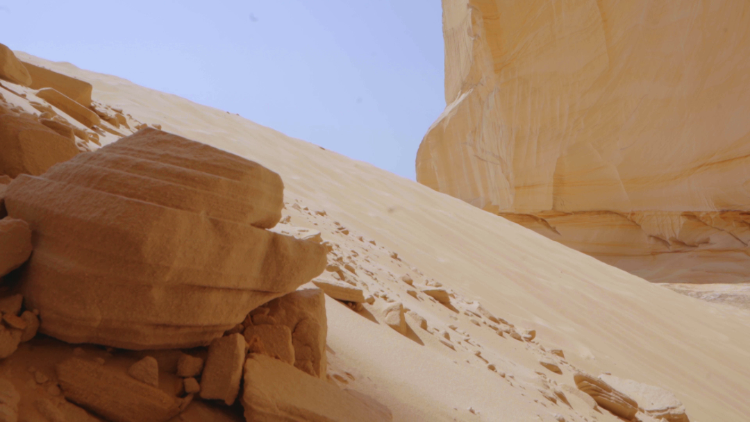
If you’ve landed on this article, you probably have already seen some of the awesome social media pictures of Cutler Point. If you haven’t this is what it looks like.


At Cutler Point lies the Great Chamber, which is the dome-like rock formation that encapsulates a tall sand hill. The rock inside the Great Chamber are striated and display a beautiful color combination of tan, orange, and brown in pristine condition. This is a perfect place for photography although be prepared to get sand in your equipment.
When we went, there was only one other party of people and they were driven there by a local tour group. They left shortly after we parked at the foot of Cutler Point so we had the entire place to ourselves for the time we were there and it was awesome. I do think that this is a less known and traveled point of interest in Utah but it’s definitely not one to be missed if you can get there.
If you want to avoid all the hassle of getting to Cutler Point though, I would highly suggest a tour group like Dreamland Safari Tours. If you’re up for an adventure, read on to learn how you can get there yourself.
_______________________

_______________________
How to Get to Cutler Point: A Guide
Vehicle
There is a portion of the drive to Cutler Point that is off road and very sandy. If you do not have experience driving in sand, I would highly suggest renting a four wheel drive vehicle with a high enough clearance. We rented a Jeep Wrangler, powered through with four wheel drive, and had zero problems. If you do not use a proper vehicle to navigate the terrain, it’s very possible you will get stuck. There is no signal there so that is an issue. You can wait for a potential tour group to come by to help you out but I wouldn’t bank on that. I’d advise you to save yourself the headache and rent a proper vehicle so you can have a peace of mind.

Directions
It takes roughly an hour or two to get to Cutler Point from Zion and the areas around Zion. We stayed in La Verkin and it took us about 1.5 hours to get there. We began with Google Maps navigating us to Inchworm Arch. I’m aware this isn’t the destination but it will get you close and it will get you driving in the right direction. This is what it looks like in Google Maps to Inchworm Arch. We took the blue route.
Don’t follow the directions all the way to Inchworm Arch. The red X’s denote the route you don’t want to follow. Where you really want to get to is Highway 89 and subsequently Johnson Canyon Road which are highlighted by the red and yellow lines respectively in the map below.
We were driving north on Highway 89 and then turned onto Johnson Canyon road to go south (yellow line).
The green box denotes the approximate location of where the entrance to the off road trails are. It’s a dirt parking lot on the right and is slightly south of where you would've turned left for Inchworm Arch. The entrance looks like this and it’s not marked:

What you’re looking for while you’re driving on Johnson Canyon Road is trail 100, denoted by the red line if you're referring to the following map from the Bureau of Land Management (BLM).
The trailhead entrance is not really marked so it does make it a bit difficult to locate but if you’re going south on Johnson Canyon road and you’ve passed a Nephi Pasture Road (as shown on Google Maps) on the left, you’re close to the entrance to trail 100. Just drive a bit more south and it should be on the right.
Once you’ve gotten to the entrance, you should use the BLM map. Do not use Google Maps at this point. Be sure to visit their website and download the PDF version of the map before you head out. This will save you from getting lost.
From here, switch into four wheel drive and drive west on trail 100 denoted by the red line in the above map. There are some markers along the way to tell you what the trails are. You will drive west on trail 100 until you hit trail 103. Once you hit trail 103, go north and it’s a straight shot from then on. This is the orange line in the map and it will bring you to the green rectangle where Cutler Point is.
Driving north on trail 103, you will come across two closed gates. Be prepared to stop, hop out, and open the gate to continue driving.
If you want a supplementary resource, check out our YouTube video tutorial:
That’s it! Enjoy the scenery while you’re driving and enjoy not only the destination but the journey as well.
_______________________
You can try Travel Mapper for free and get 10% off using coupon code HBCCD6QS! Check out this video to see all the features in action:
_______________________

